Interactive maps for a gated community
3D Tour
Aero
Interactive
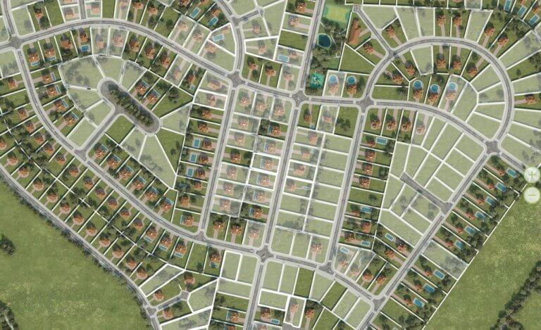
How to show the territory of an unbuilt gated community and provide information to potential clients about plots and cottages available for sale? This is one of the fairly frequent requests, that we receive and we’re gonna show you one of the possible options.
SPECIFICATIONS
Interactive maps are the best when it comes to an effective presentation. With their help, you can demonstrate the territory from a bird’s eye view, you can rotate and bring the maps closer. Clicking on a miniature of cottages or land plots opens an information window with information about the area and availability for sale. Such solutions can be easily supplemented with 3D panoramas, renders, or other types of visual content.
RESULT
There are several stages of development:
Such a project usually takes from 2 weeks to 1 month to create.